|
Urban Curiosities and other Useless Facts | |
A collection of Rotterdam-related factoids and coincidences. I like this kind of useless information. At the moment you can waste your time by reading about:
A geographic adventure - Where is Rotterdam anyway ?
I noticed that my own atlas (The Britannica Atlas) gives geographic co-ordinates for all it's cities and I became curious about it's exact location. I did some research in libraries and came up with these results:
| 51.55 N 4.30 E J.B.
Wolters , Schoolatlas der gehele aarde, 35 ed., 1936 51.55 N 4.30 E Bos Niermeyer Atlas, 37 ed, 1947 51.55 N 4.29 E Times Atlas of the World, 1955 (and Dutch edition 1983) 51.55 N 4.30 E The Hamlyns Pictorial Atlas of the World, 1976 51.55 N 4.28 E Britannica Atlas, 1986 51.55 N 4.28 E Rand Mc Nally, The New International Atlas, 1994(and 1996) 51.55 N 4.32 E Trident Press, The 21st Century World Atlas, 1998 51.55 N 4.30 E The Times Comprehensive Atlas of the World, 1999 |
The sources on the
Internet are a bit disappointing:
|
I can't locate these precise co-ordinates in the wild, because I have no GPS (I'll try to borrow it from someone). But my 1:25.000 topographic map shows the co-ordinates of two other spots near the real Rotterdam location. This was the next best thing, and I was quite excited by the opportunity to visit two completely random urban sites without any special relevance. My personal definition of Urban Exploration is still: "Visiting sites that other people ignore" and this project fits the definition perfectly.
 |
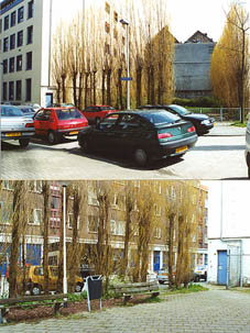
51.50 N 4.30 E
|
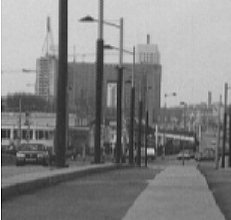
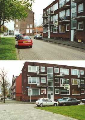
| 51.50 N 4.25 E - On the
Noordereiland, an island in the river. At the corner of
the Marinestraat. Again the spot is in a small park. A
neglected lawn, two sides enclosed by the blind walls of
buildings, two sides enclosed by scruffy Italian poplar
trees. Two dirty and broken benches and a dustbin with an
old windscreen-wiper sticking out of it. A very nice spot
to sit, except for the noise of the building-site next to
it. At the other side of the street IMREX BV sells
alarm-installations, PA-installations and portable
bullhorns. A black van belonging to a magician's act is
parked next to it. No one walks by here. This adventure sounds very simple and silly but I enjoyed it immensely. Without the co-ordinates I would have never noticed these places. I'll certainly return to the spot on the Noordereiland, it has a lot of atmosphere. An I dare to say that I'm probably the only person in the world who has visited both sites on the same day. |
 |
And what about 51.50 N 4.20 E and 51.50 N 4.35 E ? They're totally uninteresting because they're outside of Rotterdam, and out of my territory.
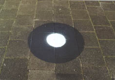
But unfortunately I already knew what it was. Like the map-lover I am, I knew that it was a marker for aerial photography. Someone will come and determine the co-ordinates of the dot and later the aerial photograph can be calibrated using these co-ordinates. Now my task was clear: "I must get hold of these co-ordinates, and then I'll know where my front door is on the surface of the Earth."
First I called the National Topographic Survey in Emmen. I got their helpdesk. "A dot on the street you say? Well, I have it somewhere in my manual, let me see ... Yes, here it is - dot on street - You should call your local utility company, the make these dots."
The utility company helpdesk was certain they didn't make any dots. My local municipal council couldn't help me either. The central geodetic bureau of Rotterdam gave me the telephone number of the Topographic Survey of the Ministry of Spatial Planning (VROM) in Delft. "Yes, we sometimes make dots, but you have to call the local bureau for your sector."
And again I got a number. "Yes, we make dots, but we're not the only ones you know. For example the railway-company also makes dots. And spring is the dot-making season, sunny, clear weather, trees still bare - ideal for aerial photography. So it could be anyone. - Yes, if it's us you can get the co-ordinates, but it might take 3-4 weeks before we have them."
So after many phone calls I still know nothing.
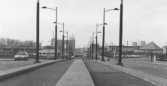
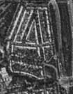
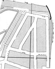
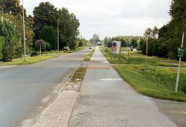
The longest street-level (ground-floor) view in Rotterdam?
I thought that the street in Schiedam (see below) was the longest and straightest street. But not so. This is probably the longest - 3,25 km - the Hoeksekade between Ommoord and Bergschenhoek. And it's also one of the oldest. It features on a map dating from 1600. It was just as straight then - 400 years ago.
 |
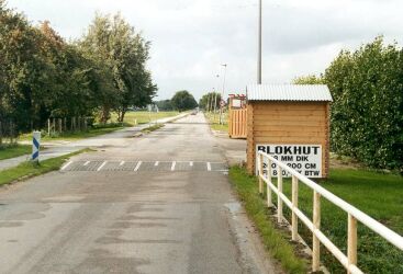 |
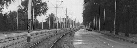
| Here you're looking Southeast towards Ommoord. The appartment building is 1,5 km away. | Here youre looking Northwest towards Bergschenhoek. You can't see that village. It's still 3 km to the village. |
But this one also isn't bad:
 |
You're standing at the Marconiplein and you are looking Eastwards towards the old center of Schiedam (Schiedamseweg + Rotterdamsedijk).
The distance is 1,9 km. Maybe!
It is surprisingly difficult to determine where this view ends. Even with good binoculars it's impossible to see the end of this road. The clutter of lampposts, traffic-lights, roadsigns, trees and electricity masts obscures the features at the other end of the road. (Technically speaking: "the signal to noise ratio in this view is very bad".)
One way to solve the problem would be to use two people with GSM-phones at both ends of the street. One would carry a flashlight and the other a good telescope. Then it would be easy to check if a "line of sight" really exists. A laser-beam would be ideal for this purpose.
Who wants to help me with this project?
I enjoy "soft" urban adventures. They are not illegal, they are not dangerous but still they're non-standard and exciting.
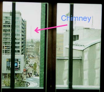
For example, around 16 October 1999 we had a spell of beautiful sunny days. I noticed that the sun was setting around the time I came home (18:30) and that it was shining directly into my eyes. The sun's rays were exactly parallel with the street-grid.
I've read a lot about stone circles and prehistoric observatories and their astronomic orientations. But it's surprising to find the same thing occuring at your doorstep. Would it be possible to photograph this special alignment?
 |
 |
 |
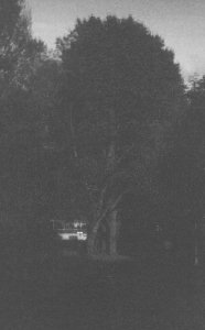
| First I tried
photographing the last rays of light shining along a
narrow bicycle path and between the trees. You can see the last speck of light shining into the living room on the first floor of an appartment building. |
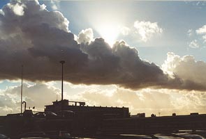
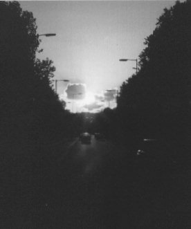
Then I
tried to photograph the sunset itself. It's difficult to
get the right shutter speed. But I don't like wasting
several pictures to get it exactly right. Here the sun is going down above the viaduct of the A20 highway. It shines almost parallel to the "Prinsenlaan". This street has an WSW-orientation. It's a pity that there were some low clouds on the horizon. |
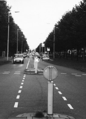
This is
the same spot but I've turned around 180 degrees. The sun is shining exactly along the road and it lights up the reflective traffic signs and lampposts. But otherwise the sun's rays are already too weak to notice in this picture. These are dangerous evenings. Car drivers are blinded by the light and they hit oncoming trains at rail crossings. |
Back to: Home.
© 1999 Petr Kazil - 21 July 2002